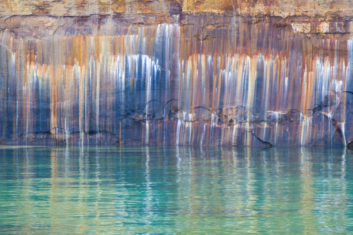
The name Pictured Rocks is derived from an old term used by French explorers. When they first encountered the vibrant cliffs along Lake Superior’s shorelines, they referred to them as “Les Roches Peintes,” which translates “the painted rocks.” Over time this evolved into the English term “Pictured Rocks.”

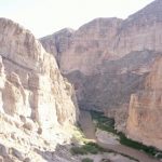
We saw the cliffs from above first. This 42 miles of shore on Lake Superior was designated a National Lakeshore in 1965. The sandstone cliffs can be up to 200 ft above lake level. There are arches, other formations, waterfalls and caves.

Miners Castle


12 Mile Beach was a cute little surprise


Hurricane River flows out of the woods right into Lake Superior and don’t miss that cute little bridge


Log slide is an area previously used for the logging industry. They said it can take 10 minutes to go down and over an hour to get back up.

Au Sable Light Station


Danger boy. This was a little too steep for Kristi

Miners Beach


Iron ore, copper, calcium and manganese are some of the minerals that seep through the sandstone to create the amazing variety of colors.


Those guys must be so cold, the water is in the 50’s!


It was so cold! But we stayed on the top of the boat the whole tour. Here they took the boat deep into a cove that was really cool and then had to go out in reverse


If you look closely, the tree on that formation has roots that reach over to the mainland. This is because there used to be sandstone underneath the roots and it collapsed but the tree and roots remained.


Grand Island East Channel Lighthouse

All they need is an “i” on the end!

The sunset over Lake Superior at our campsite each night was incredible and turned very red just before it set each night after 9 pm!