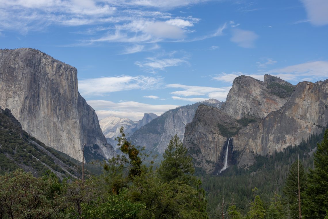
Teddy Roosevelt made this a National Park in 1906. This place is pretty magnificent and one of the top parks on every list out there. We could go on and on about it but maybe the pictures will speak for themselves. The talk is that the park is so busy you might wait hours to get in, but we were able to go right in both days. This park has more lodging, camping and food available than most parks and we don’t have pictures of the amazing steaks we had for dinner at The Mountain Room after hiking.

Our first look at Upper Yosemite and Lower Yosemite Falls

Up close to Lower Falls – the mist was very heavy – you’d be soaked if you stayed long – we did about a 1 mile walk in to get close. The Upper Falls has a much more serious trail that we did not attempt – 7 miles with a 2700 ft elevation gain!


The sunset on Half Dome – as seen from Mirror Lake area

We reached Mirror Lake right at sunset – about a 2 mile hike. The lake dries up in summer and we caught it when it was getting kinda mucky and stagnant.

Large granite boulders around Mirror Lake – said to have fallen from the cliffs above and around

Natural rock entrance into the park

View of Half Dome from Glacier Point. It was about a 1 hour drive to Glacier Point which is arguably one of the best lookout views in the entire United States!

Various views of the cliffs and valley from Glacier Point

The lodge and river below in the valley

A fire that was burning each day we were there. This is across from Glacier Point. All hiking up Half Dome was shut down due to this fire.
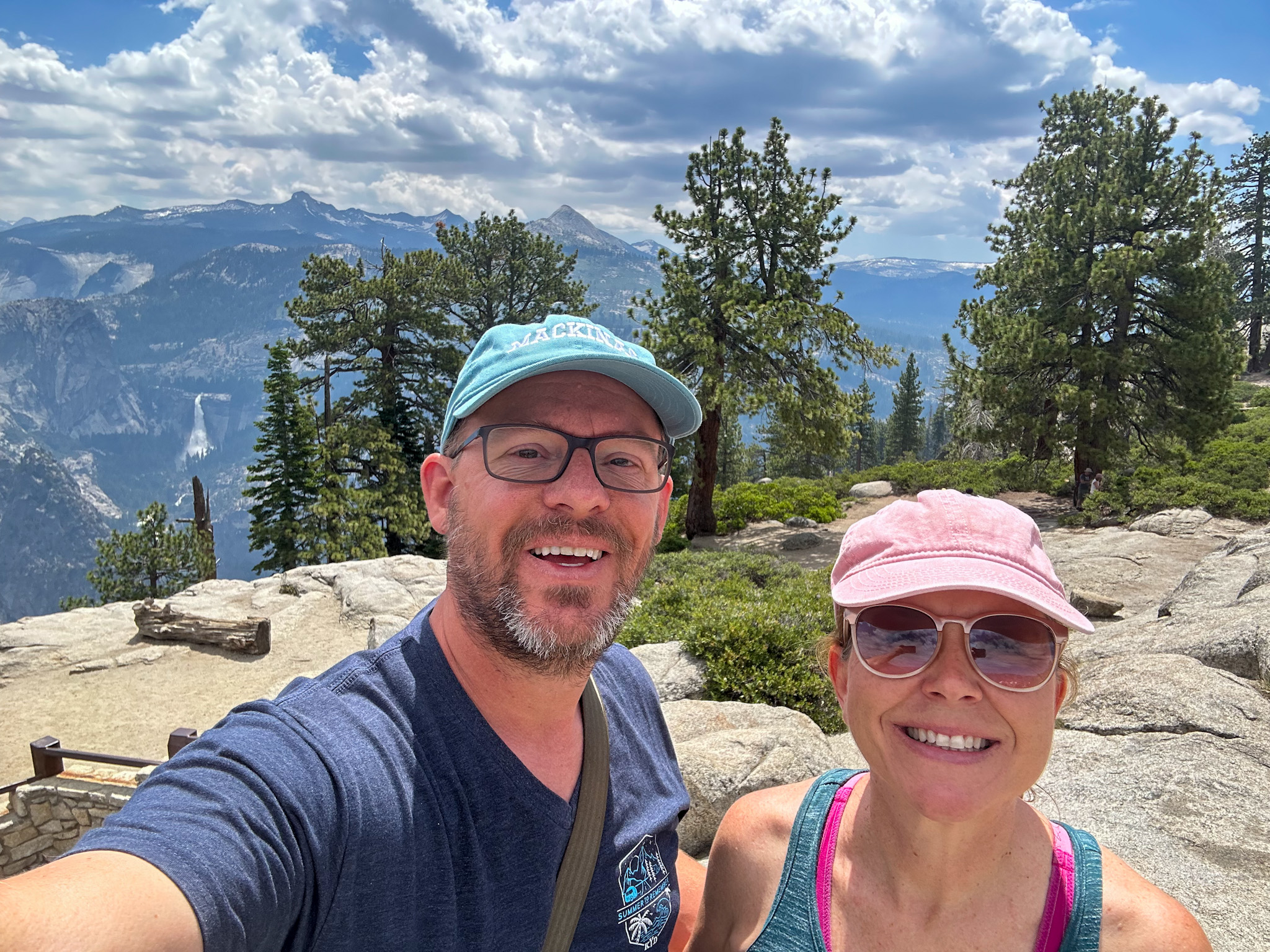
Glacier Point – 7,214 ft elevation. We were told you can only see 1/4 of Yosemite from up there but it felt like you could see a panoramic view of the whole world.

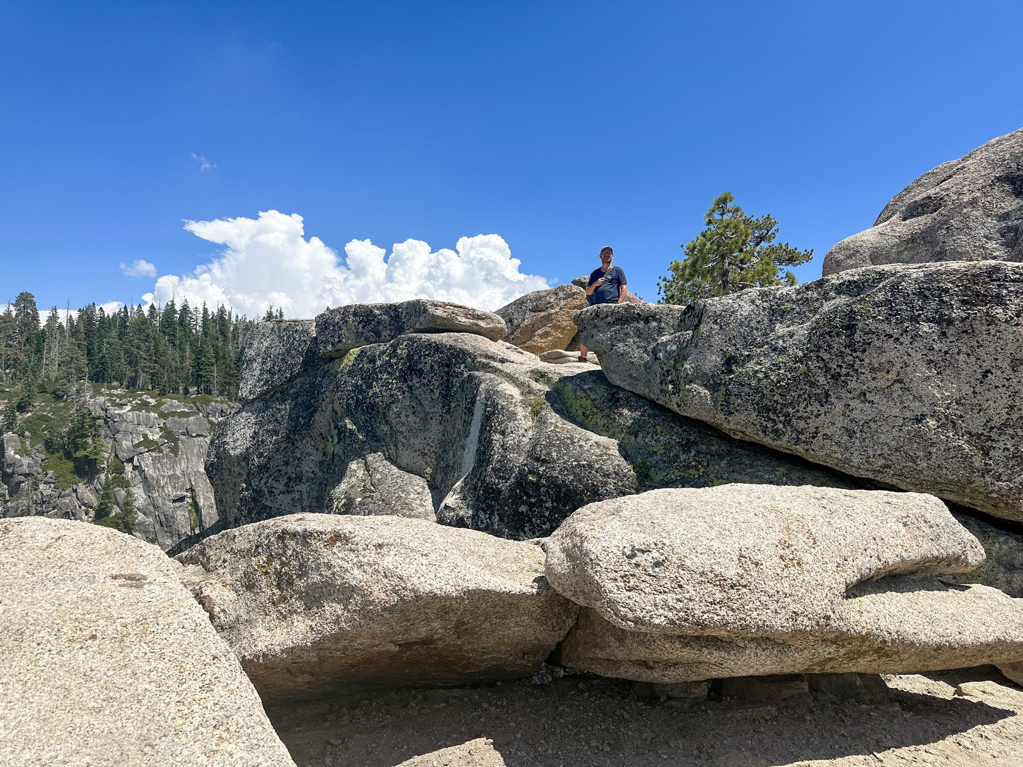
One of the viewing areas at Glacier Point

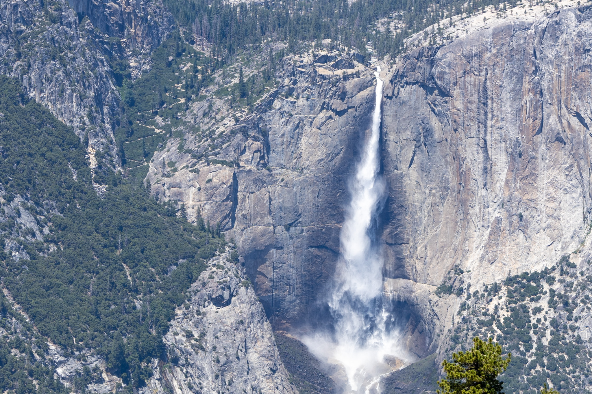
View of Nevada Falls (upper) and Vernal Falls (lower) from Glacier Point – stay tuned because we’ll attempt to hike up to those coming up.

Jerry visiting Yosemite as a teen. We don’t know the year but we spent a while trying to find that same spot. We have no idea why he took a picture with that look on his face, but the only reason we think his face could possibly look like that in such a beautiful place is because he hasn’t met Kristi yet.

We think this is close to the spot where he was. We were looking all over on a trail at Glacier Point, but nothing seemed like the right perspective. Finally we left and pulled into an overlook called Washburn Point, just to see it, and it clicked – this looked like it!

He finally got to take the photo with a smile on his face!

Here he is scouting high and low and to and fro to find where he’d actually been standing those many years ago

This tree was along the trail to Taft Point.

It started out like so many other trails we’ve done, trees through the woods and then it opened up to magnificent granite and cliffs and fissures and views

The Taft Point Trail is definitely not celebrated enough. The ending was incredible on this 2.3 mile trail. We were told President Taft himself had been on this trail even though he was a relatively large man, and that is how it was named. Jerry chose it because of the presidential name and we’re so glad he did because we loved it.

Fissures along the rocks – kinda shocking – you’re walking along and suddenly there’s a big huge fissure going down hundreds of feet

The end of the trail near the cliffs is very reminiscent of Stone Mountain in Georgia, which we love

A geological marker at the summit of Taft Trail – elevation 7,503

Upper Falls from Taft Point and to the left of the falls showing the crazy path that is the Upper Falls Trail.


She might look brave and adventurous but she’s a very safe distance from the edge


The beginning of the Mist Trail up along Vernal and then Nevada Falls

The waters were raging and loud – you can see Vernal Falls peeking out at the top – this was taken from Vernal Fall footbridge


The trail went up those steps and around and at that point the mist was very heavy. We only went a little ways up the steps. It was late, almost sunset and our 3rd hike of the day and Kristi wasn’t a huge fan of the wet stairs on the side of the cliff.
Most people were completely drenched coming back down from this area. We came prepared with our rain gear


The view heading back down. If you look across, you can see Glacier Point where we were earlier in the day and took a photo of this very spot

The other side of El Capitan at sunset